About
The Parish of Somerford Keynes
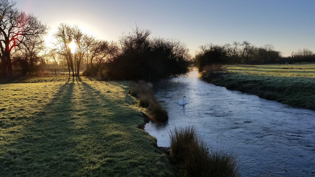
Somerford Keynes is in Gloucestershire about 5 miles south of Cirencester against the Wiltshire border alongside the river Thames
There has been a Christian settlement here since at least AD685, the year that the building of Gloucester Cathedral started. We also know the Romans were here, and archaeological digs before gravelling have shown evidence of much earlier occupation. Until 1897 we were in Wiltshire. On the formation of the civil parishes and proper County Councils in that year, the locals chose to be in Gloucestershire (by 3 votes to 2!!). In those days we had a pub, a school, at least one shop and a vicar to ourselves (Shorncote was amalgamated with us in the 1880s).
The school closed in 1968, the shop in the 1980s and we now share the Vicar with eight other parishes. The pub still survives, kept alive by the visitors to the holiday village “Lower Mill Estate” that sprung up across the Spine Road starting in 1999. When completed, this will have 400 houses, against the resident population of about 140 houses in Somerford Keynes.
Shorncote is a hamlet with a redundant church about a mile to the northeast of Somerford Keynes. There are a number of outlying houses and farms. Since the 1960s, much of the parish and of the surrounding area has gone underwater, as the Thames gravels are dugout. The area between us and Lechlade, some twenty miles downstream, has been designated as the Cotswold Water Park since 1968. There is no water splash fun park, (that usage of the words has developed elsewhere more recently), but there is a great deal for the interested visitor to see and do. Consult our Things to do page for suitable links. The source of the River Thames is officially four miles upstream, but in a normal dry summer, can be downstream towards Ashton Keynes. The National Trail known as the Thames Path passes right through the parish. We have two Country Parks. Neigh Bridge Park is just across Neigh Bridge. Keynes Country Park, now called the Cotswold Park and Beach, is mostly in our parish, although half of the southern lake is in Wiltshire. The old field boundary marking the county boundary across the middle of the lake shows up in very dry summers. Do check out village activities on our Todo, Village Hall, Church and Parish Council pages.
What of our history?
Somerford means a ford that can only be used in summer. We got the Keynes from a Norman landlord from Cahaignes, in Normandy. Shorncote means “cottage in a muddy hollow” Archaeologists have found evidence that there was a bronze age boundary line between Somerford and Ashton just where the boundary is today while exploring before gravel digging on the Hill’s site. An item appeared in British Archaeology in November 1999. Sadly, now behind a paywall. There is archaeological evidence of Romans working nearby, but the first written evidence of occupation here was in 685AD in the Charters of Malmesbury Abbey, now online with translation. [Well sadly no longer online, but in a scholarly tome costing £70, or at Wiltshire Archives]. We are in the Domesday Book, which was initiated by King William while in Council in Gloucester. The translation (expanded) reads LAND OF THE BISHOP OF LISIEUX. The Bishop also holds SOMERFORD. Alfwald held it before 1066; it paid tax for 10 hides. Land for 7 ploughs, of which 5 hides in lordship; 3 ploughs there; 5 slaves; 14 villagers and 8 smallholders with 4 ploughs. A mill which pays 10s; meadow, 100 acres; woodland 3 furlongs long and 2 furlongs wide. Value £7. There is an excellent local history written by Canon Gibbons in 1968 called “Through the Saxon Door”, still available in the church for £5, or on the web for about £25! It explains how we got the Keynes and other mysteries. For historical maps of the area, see KYPwest.org.uk
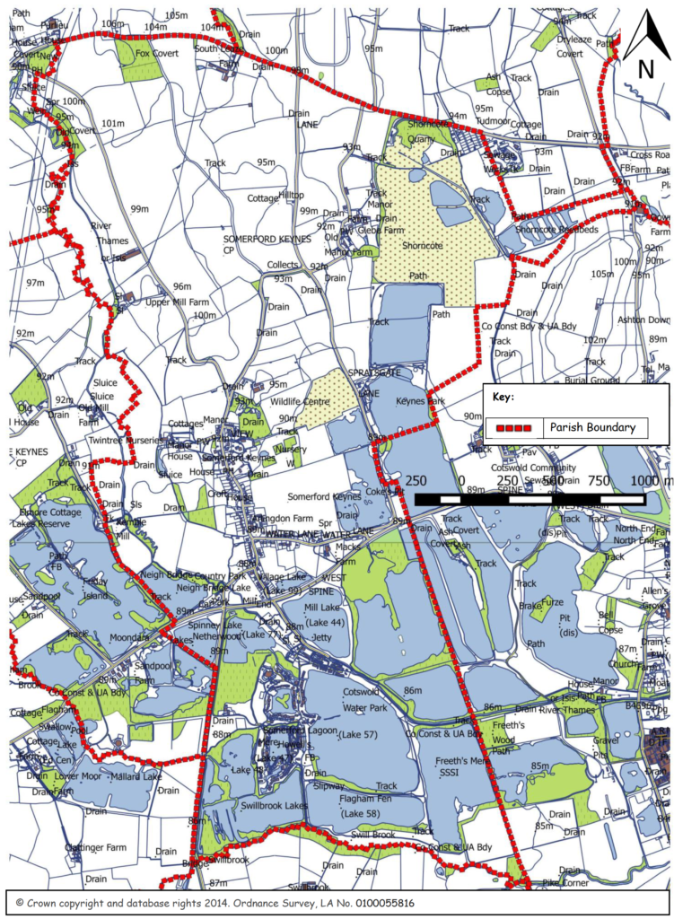
The solid line is the current parish boundary, which has changed over the years. It is believed that the square-cut bite out of the north-eastern corner was taken when the then RDC built a sewage farm, which happened before the creation of Civil Parishes in 1895. That area today contains modern sewage works, but the village is not connected to it. There are no public sewers in the village; we suspect we may be the largest village without public sewers in England. The new Lower Mill Estate is connected to the sewage works by a long pumping main. Our east and south boundary is the County Boundary of Wiltshire, as is part of Minety Lane. North of the Spine Road the western boundary more or less follows the Thames. A road forms the northern boundary. The Parish Council has extended our boundary by taking in Neigh Bridge Country Park and Lake 63, the lake immediately to the south of it across the Spine Road. No one lives in this area, and Poole Keynes, its previous parish, had no objection. The CDC made an order to this effect in February 2014, which came into effect 1st April 2015. There is also a very large map of the Parish on this site showing what we understand of the drainage of the area, which the Parish Council has been concentrating on for some years.
For more on our history visit the History Group pages and village timeline.